
Our team of professionals are experts at mapping radon risk.
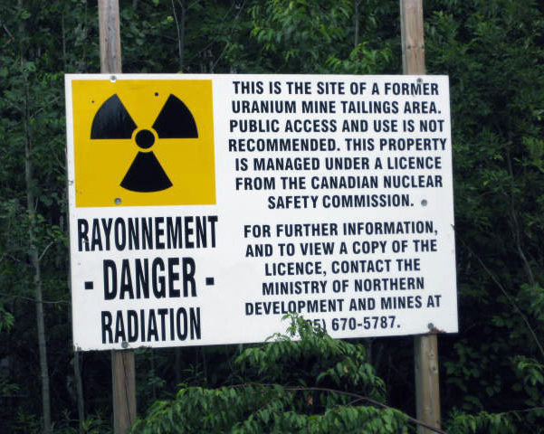
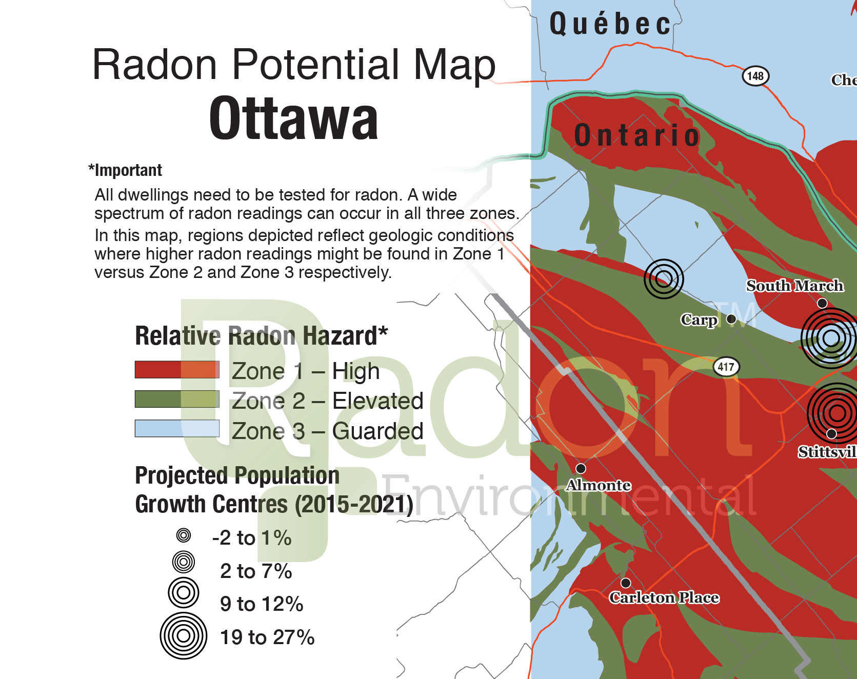
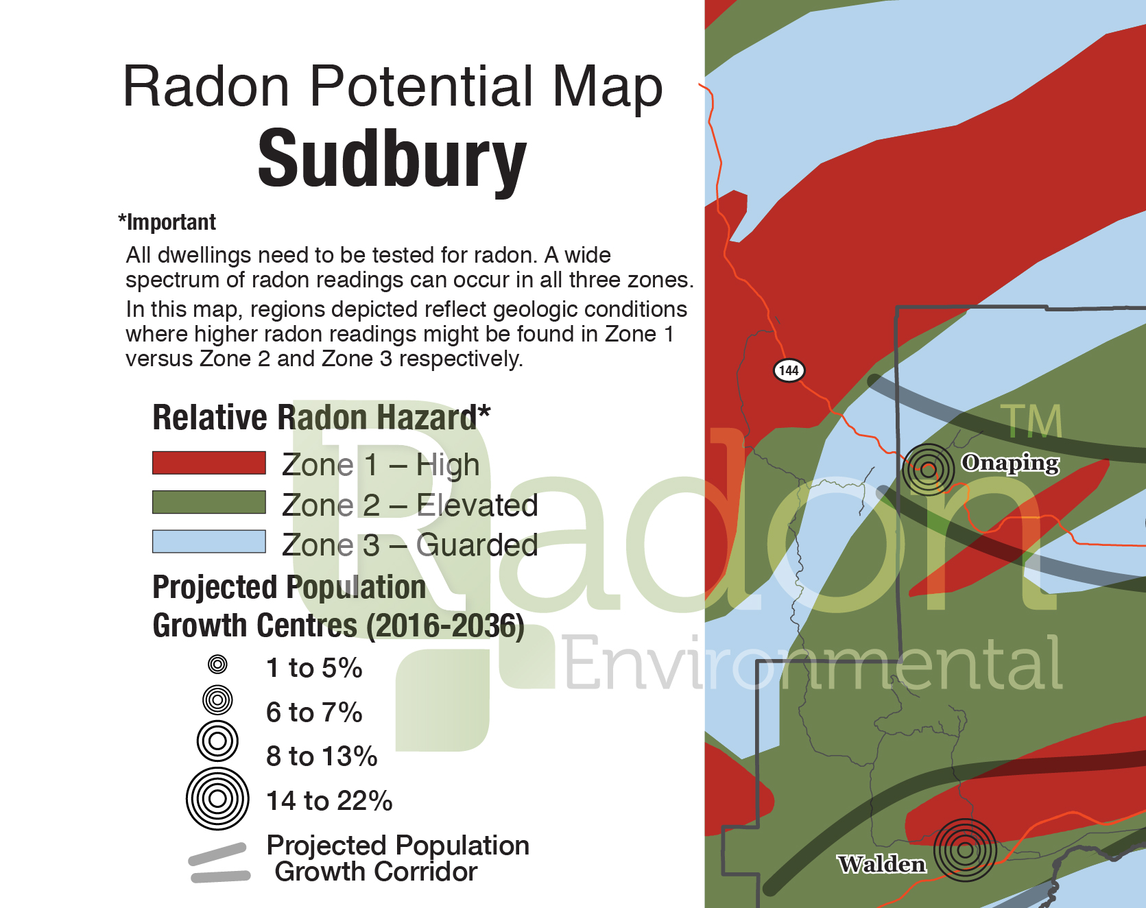
Approximately 80% of the most densely populated areas of Canada are in elevated or high radon potential zones.
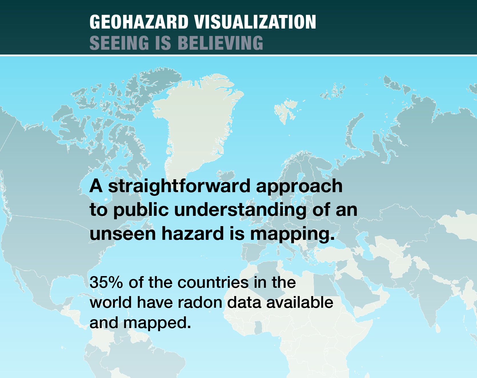
Around the world, countries with active radon programmes utilize radon risk maps in their communications. Natural hazards like radon have a strong geospatial component, and maps have a decisive role in communicating risk information.
The United States and European Union use radon maps to plan and target outreach campaigns for high risk areas and the prevention of radon accumulation in new buildings.
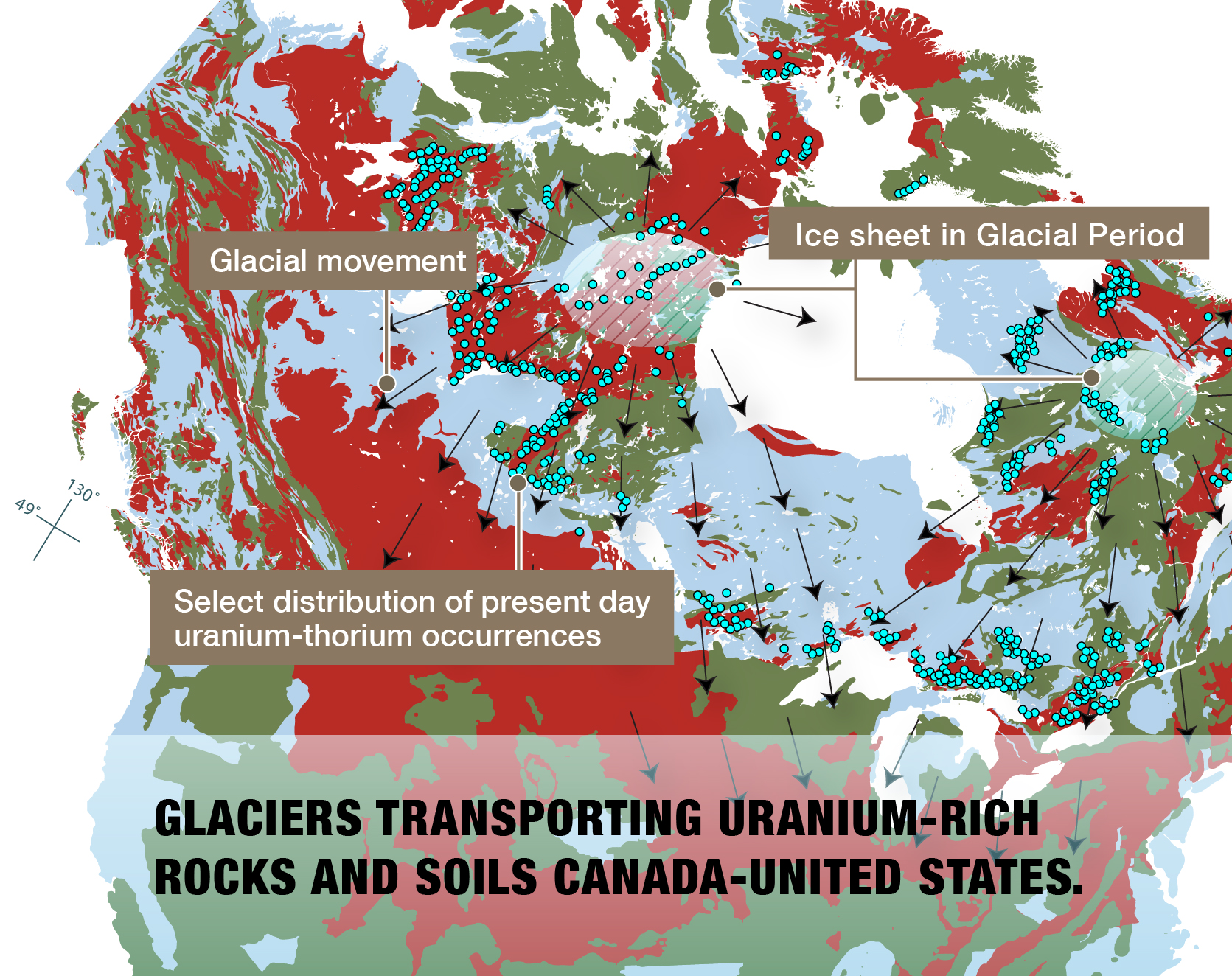
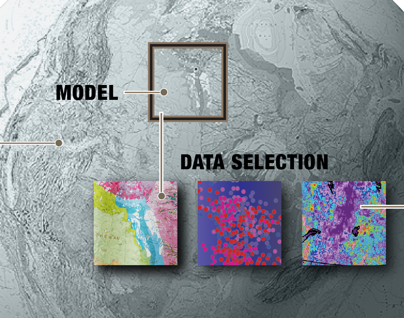
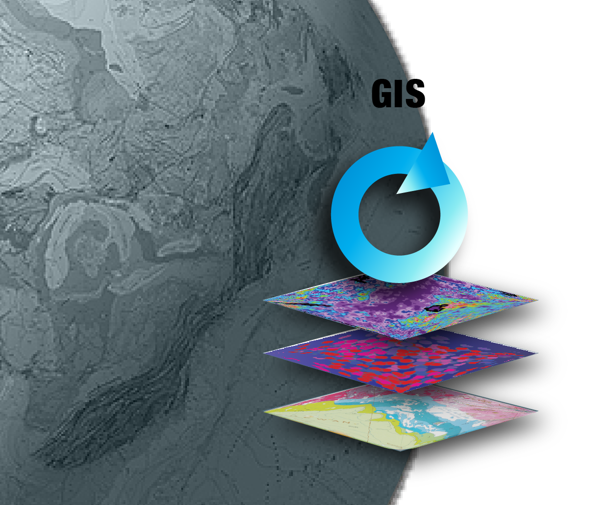
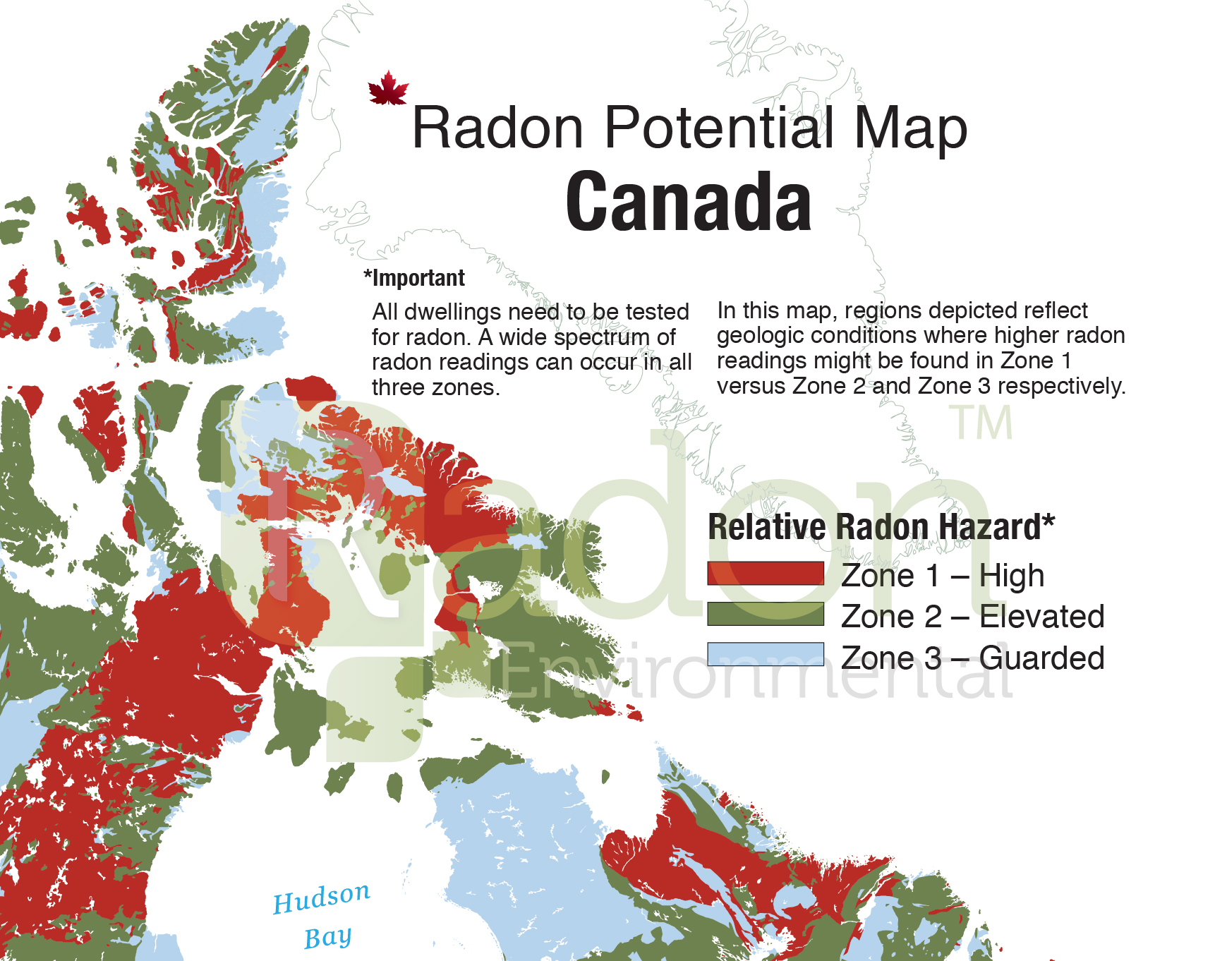
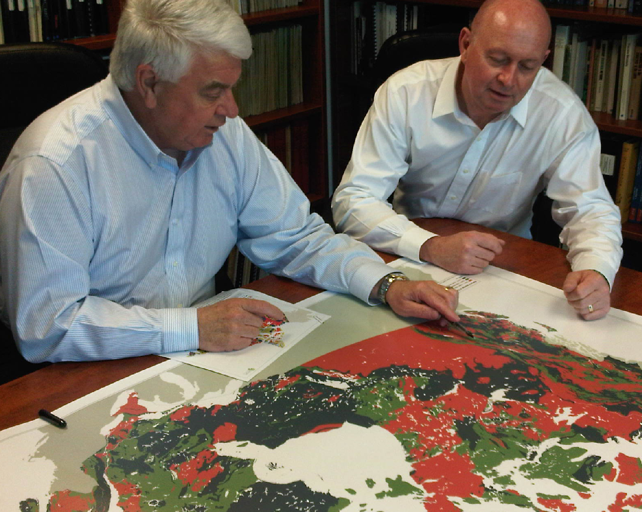
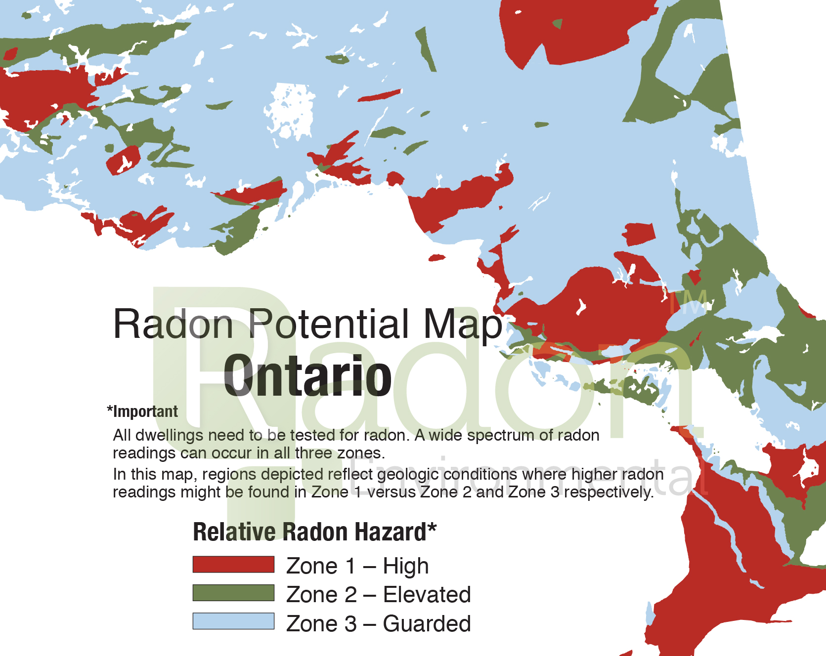
In 2010 Radon Environmental engaged a team of geoscientists to produce a geology based Radon Potential Map of Canada, the first of its kind for the country.
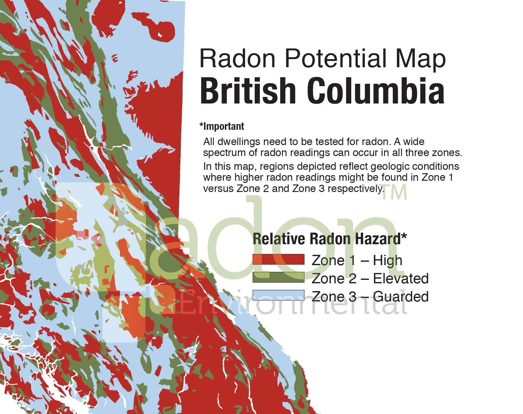
Since publishing the map in 2011, the company has produced provincial maps for public health authorities and is developing regional municipal maps for direct use in community planning applications.
Radon Potential Map of Canada news release.